
Level Up Rice Yields with Precision Irrigation and Resource Conservation
These technologies involve shaping rice paddy soil surfaces into straight, horizontal planes to enable uniform water distribution. Laser-guided leveling is a prominent method, significantly enhancing soil moisture control and water use efficiency. In regions like Cambodia and India, this practice has led to improved germination rates, reduced labor requirements, decreased weed infestations, and increased rice yields.
This technology is TAAT1 validated.
Adults 18 and over: Positive medium
The poor: No impact
Under 18: Positive low
Women: Positive low
Climate adaptability: Highly adaptable
Farmer climate change readiness: Significant improvement
Biodiversity: Positive impact on biodiversity
Carbon footprint: A bit less carbon released
Environmental health: Moderately improves environmental health
Soil quality: Improves soil health and fertility
Water use: Much less water used
In the near future, this section will provide an overview of this technology's success in various contexts, details on partners offering technical support, training, and implementation monitoring, along with other valuable insights for your projects and programs. These details will be added progressively.
In the meantime, use the 'Request information' button if you need to contact us.
Hand-operated pumps
Solar-powered pump
High-pressure pumps
Unknown
Scaling Readiness describes how complete a technology’s development is and its ability to be scaled. It produces a score that measures a technology’s readiness along two axes: the level of maturity of the idea itself, and the level to which the technology has been used so far.
Each axis goes from 0 to 9 where 9 is the “ready-to-scale” status. For each technology profile in the e-catalogs we have documented the scaling readiness status from evidence given by the technology providers. The e-catalogs only showcase technologies for which the scaling readiness score is at least 8 for maturity of the idea and 7 for the level of use.
The graph below represents visually the scaling readiness status for this technology, you can see the label of each level by hovering your mouse cursor on the number.
Read more about scaling readiness ›
Uncontrolled environment: tested
Used by some intended users, in the real world
| Maturity of the idea | Level of use | |||||||||
| 9 | ||||||||||
| 8 | ||||||||||
| 7 | ||||||||||
| 6 | ||||||||||
| 5 | ||||||||||
| 4 | ||||||||||
| 3 | ||||||||||
| 2 | ||||||||||
| 1 | ||||||||||
| 1 | 2 | 3 | 4 | 5 | 6 | 7 | 8 | 9 | ||
| Country | Testing ongoing | Tested | Adopted |
|---|---|---|---|
| Kenya | –No ongoing testing | Tested | Adopted |
| Nigeria | –No ongoing testing | Tested | Adopted |
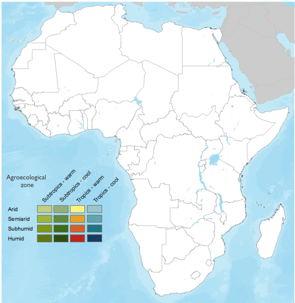
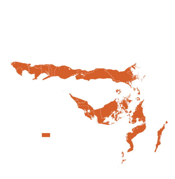
This technology can be used in the colored agro-ecological zones. Any zones shown in white are not suitable for this technology.


| AEZ | Subtropic - warm | Subtropic - cool | Tropic - warm | Tropic - cool |
|---|---|---|---|---|
| Arid | – | – | – | – |
| Semiarid | – | – | – | – |
| Subhumid | ||||
| Humid |
Source: HarvestChoice/IFPRI 2009
The United Nations Sustainable Development Goals that are applicable to this technology.


Prepare the Field: Ensure the rice paddy is sufficiently wet.
Calibrate Instruments: Set up and calibrate topographic survey instruments.
Measure the Land: Take precise measurements to design appropriate soil surfaces.
Level the Field: Utilize tractor-mounted tools guided by laser technology to level the field.
Verify Surface Dimensions: Conduct another land survey to ensure the dimensions of soil surfaces are correct.
Last updated on 7 November 2025