
TAAT e-catalog
for
government
https://e-catalogs.taat-africa.org/gov/technologies/farmrise-digital-platform-for-advisory-and-crop-management
Expert farming solutions at your fingertips
FarmRise is a digital platform that supports agricultural service delivery by connecting farmers, agricultural advisors, agrodealers, input providers, and other agricultural service actors. It strengthens farmer registration, digital farm data management, advisory delivery, and access to digital farming solutions, while facilitating the use of weather information, crop health diagnostics, product verification, and agricultural product information. By improving the availability of farmer data, personalized recommendations, and information sharing across the agricultural value chain, the platform enhances decision-making, strengthens farmer engagement, and improves the accessibility and effectiveness of agricultural services through mobile-based digital solutions. Currently implemented in Kenya, FarmRise is adapted to local farming systems through, locally relevant advisory content, and integration with the Kenyan agricultural service ecosystem.

This technology is pre-validated.
| Target Groups | Positive Impacts |
|---|---|
| Women smallholder farmers and women engaged in agricultural production |
|
| Smallholder farmers |
|
| Smallholder farmers in remote and low connectivity areas |
|
| Farmer groups and agricultural producers |
|
Climate adaptability: Highly adaptable
FarmRise is designed to work across a wide range of agroecological zones by combining localized weather data, agronomy recommendations, crop diagnostics, and location-based services.
Farmer climate change readiness: Significant improvement
FarmRise helps farmers adapt to climate change by providing localized weather forecasts, rainfall, temperature and humidity updates, expert agronomy advice, region-specific hybrid recommendations, and crop disease diagnostics that enable farmers to make better decisions before, during, and after the season.
Biodiversity: Positive impact on biodiversity
Through localized weather forecasts, agronomy advice, hybrid recommendations, and crop disease diagnostics, FarmRise helps farmers improve crop health, reduce losses from pests and diseases, and optimize the use of agricultural inputs. For livestock-producing households, the weather and advisory information indirectly support animal welfare by helping farmers plan feed production and farm activities around weather conditions. For nature and the broader environment, FarmRise supports climate-resilient farming practices by enabling farmers to respond to changing weather conditions, select suitable crop varieties, and improve resource management.
Environmental health: Greatly improves environmental health
FarmRise improves environmental health by helping farmers make better and informed decisions that can reduce waste, improve resource efficiency, and support more sustainable farming practices.
Soil quality: Not yet estimated
FarmRise indirectly support soil health and fertility by helping farmers make better agronomic decisions through weather updates, crop advisory services, crop diagnostics, and access to agronomy expertise.
Weak coordination among agricultural service actors: Fragmented interactions among farmers, advisors, agrodealers, and input providers reduce service efficiency and limit coordinated support across the agricultural value chain.
Limited availability of digital farmer and farm data: The absence of structured and reliable farmer information constrains personalized recommendations, service planning, monitoring, and data-driven agricultural decisions.
Crop health and input management constraints: Insufficient access to early disease diagnosis, treatment guidance, and product verification increases crop losses and risks related to agricultural inputs.
Limited adoption of digital farming solutions: Barriers related to digital literacy, smartphone access, and connectivity reduce farmers’ ability to benefit from digital agricultural services.
Inefficient delivery of agricultural advisory services: Traditional service delivery approaches and limited information sharing reduce the accessibility, timeliness, and effectiveness of agricultural support.
Crop health management and product verification: Supports disease identification, treatment recommendations, and agricultural product authentication, helping farmers reduce crop losses and avoid risks associated with counterfeit inputs.
Digital farmer data management: Captures farmer and farm information to enable personalized recommendations, improve service targeting, and support data-driven agricultural decision-making.
Stakeholder engagement and service delivery: Connects farmers with agricultural advisors, agrodealers, and input providers, improving access to agricultural solutions and strengthening interactions across the value chain.
Digital service accessibility: Delivers mobile-based agricultural services adapted to local farming systems, including multilingual support and solutions designed for farmers in rural communities.
FarmRise is a digital platform that connects farmers with agricultural advisors, agrodealers, input providers, and other agricultural service actors. By supporting farmer registration, digital farm data management, agronomic advisory, weather information access, crop diagnostics, and product verification, the platform helps agricultural stakeholders improve service delivery, strengthen farmer engagement, and support data-driven farming decisions.
Current platform access is primarily designed for farmers in Kenya and requires an Kenyan phone number (+254). Organizations planning deployment outside Kenya should confirm country-specific registration, localization, and onboarding requirements with Bayer.
To integrate this technology into agricultural programs and investments, stakeholders should consider the following actions and prerequisites:
Identify priority production areas and farming communities where farmers face challenges accessing reliable agricultural information, advisory services, crop health support, and agricultural inputs.
Establish partnerships with Bayer, agricultural extension services, agrodealers, farmer organizations, input providers, and other agricultural value chain actors.
Support the deployment of the platform and the registration of farmers to establish reliable digital farmer and farm records.
Train extension agents, field officers, and implementing partners on farmer registration, farm data collection, digital advisory delivery, and farmer support.
Integrate digital farmer and farm information into agricultural planning, targeting, monitoring, and decision-making systems.
Promote the use of digital advisory services, weather information, crop diagnosis tools, and product verification features available through the platform.
Leverage mobile-based digital functionality to improve access to agricultural services among farmers, including those in rural and underserved areas.
Implement awareness campaigns and digital literacy activities to encourage adoption among farmers, advisors, and agricultural service providers.
Track key indicators such as farmers registered, digital farm profiles created, advisory services accessed, crop diagnoses performed, products verified, and stakeholders engaged.
Develop long-term institutional partnerships and sustainability mechanisms to support continued use, scaling, and adaptation of the platform within agricultural service ecosystems.
Open source / open access
Scaling Readiness describes how complete a technology's development is and its ability to be scaled. It produces a score that measures a technology's readiness along two axes: the level of maturity of the idea itself, and the level to which the technology has been used so far.
Each axis goes from 0 to 9 where 9 is the “ready-to-scale” status. For each technology profile in the e-catalogs we have documented the scaling readiness status from evidence given by the technology providers. The e-catalogs only showcase technologies for which the scaling readiness score is at least 8 for maturity of the idea and 7 for the level of use.
The graph below represents visually the scaling readiness status for this technology, you can see the label of each level by hovering your mouse cursor on the number.
Read more about scaling readiness ›
Uncontrolled environment: validated
Common use by intended users, in the real world
| Maturity of the idea | Level of use | |||||||||
| 9 | ||||||||||
| 8 | ||||||||||
| 7 | ||||||||||
| 6 | ||||||||||
| 5 | ||||||||||
| 4 | ||||||||||
| 3 | ||||||||||
| 2 | ||||||||||
| 1 | ||||||||||
| 1 | 2 | 3 | 4 | 5 | 6 | 7 | 8 | 9 | ||
| Target Groups | Positive Impacts |
|---|---|
| Women smallholder farmers and women engaged in agricultural production |
|
| Smallholder farmers |
|
| Smallholder farmers in remote and low connectivity areas |
|
| Farmer groups and agricultural producers |
|
| Target Groups | Unintended Impacts | Mitigation Measures |
|---|---|---|
| Women smallholder farmers and women engaged in agricultural production |
|
|
| Youth and young agricultural entrepreneurs |
|
|
| Smallholder farmers in remote and low connectivity areas |
|
|
| Farmers with limited digital literacy |
|
|
| Target Groups | Barriers to Adoption | Mitigation Measures |
|---|---|---|
| Women smallholder farmers and women engaged in agricultural production |
|
|
| Youth and young agricultural entrepreneurs |
|
|
| Smallholder farmers in remote and low connectivity areas |
|
|
| Farmers with low digital literacy |
|
|
| Country | Testing ongoing | Tested | Adopted |
|---|---|---|---|
| Kenya | –No ongoing testing | –Not tested | Adopted |
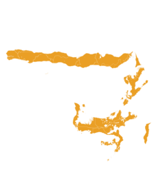
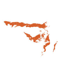
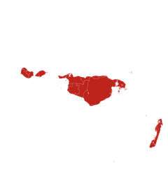
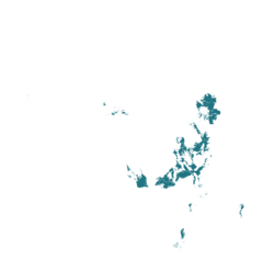
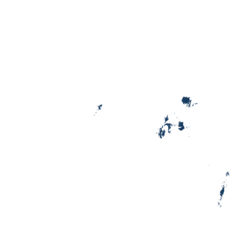
This technology can be used in the colored agro-ecological zones. Any zones shown in white are not suitable for this technology.
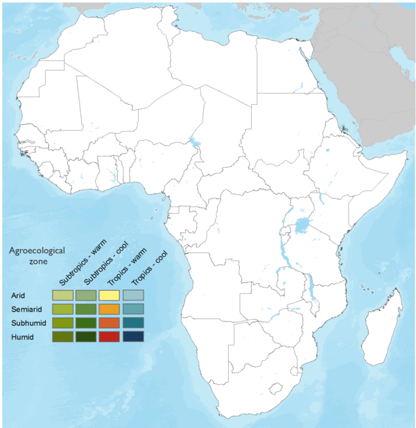



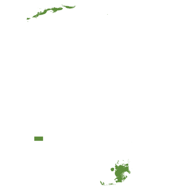

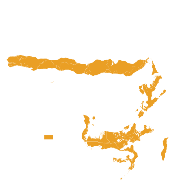
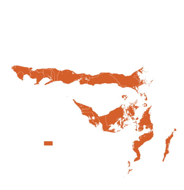


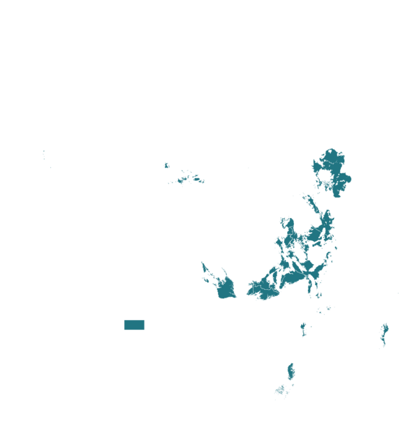
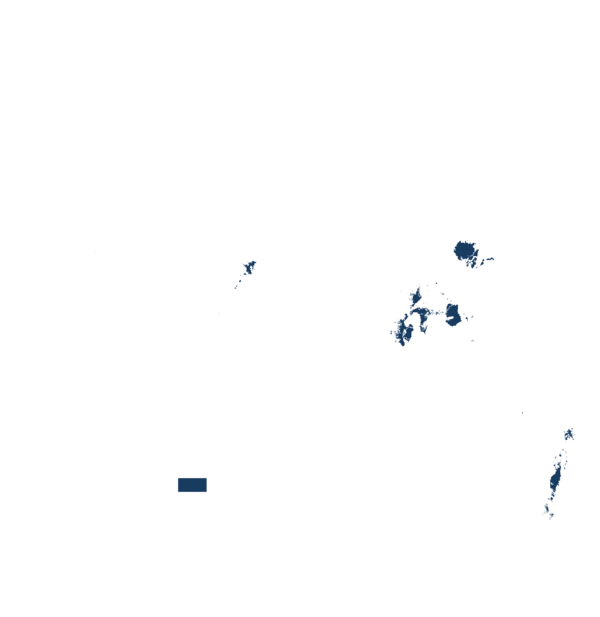
| AEZ | Subtropic - warm | Subtropic - cool | Tropic - warm | Tropic - cool |
|---|---|---|---|---|
| Arid | – | – | – | – |
| Semiarid | ||||
| Subhumid | ||||
| Humid | – |
Source: HarvestChoice/IFPRI 2009
The United Nations Sustainable Development Goals that are applicable to this technology.
FarmRise targets smallholder farmers and aims to improve productivity and profitability through agronomy advice, value-added services, access to financing/marketplace opportunities, and better farming decisions.
FarmRise supports food security by helping farmers improve crop management through weather updates, agronomy advisory, Crop Doctor, product catalogue, hybrid/seed recommendations, and access to genuine inputs.
FarmRise contributes to farmer income opportunities by supporting productivity, profitability, advisor engagement, agrodealer linkages, and potential credit/financial access.

FarmRise is a digital agricultural innovation platform that strengthens farmer decision-making through mobile-based advisory, weather data, product verification, and crop diagnostics.
FarmRise supports more responsible input use through agronomy advisory, weather-informed decisions, product information, and product authenticity verification, helping farmers choose and use agricultural inputs more appropriately.

FarmRise supports climate adaptation through weather updates, weather accuracy improvements, agronomy advisory, and crop diagnostics.
FarmRise indirectly supports land and ecosystem health by enabling better crop management, input efficiency, product authenticity, and climate-smart decisions.

FarmRise’s growth strategy includes strategic partnerships with telcos, cooperatives, NGOs, agrodealers, and agricultural programs.
Step-by-Step:
Step 1 – Download and install the FarmRise application
Download the FarmRise mobile application from the Google Play Store and install it on an Android smartphone to access digital farming services.
Step 2 – Register an account
Create an account using a valid Kenyan mobile phone number (+254) to access FarmRise services. The platform is currently designed for farmers in India and adapted to the local agricultural context.
Step 3 – Add farm information
Enter farm details, including location, crops, and planting information, to enable tailored recommendations and digital services.
Step 4 – Access agricultural advisory services
Farmers receive personalized agronomic recommendations, crop management guidance, and best farming practices through the platform.
Step 5 – Check weather information and alerts
Farmers access localized weather forecasts and alerts to support decisions related to planting, irrigation, spraying, and harvesting.
Step 6 – Diagnose crop health issues
Farmers upload images of affected crops through the Crop Doctor feature to receive AI-based disease identification and treatment recommendations.
Step 7 – Verify agricultural products
Farmers scan QR codes on Bayer products to verify authenticity and reduce risks associated with counterfeit inputs.
Step 8 – Explore agricultural products and solutions
Farmers access Bayer product information, recommended solutions, and crop-specific guidance to support input selection and usage.
Step 9 – Connect with agricultural service providers
Farmers access nearby agrodealers, agricultural advisors, and farmer events to improve access to products, services, and technical support.
Step 10 – Use digital recommendations throughout the farming cycle
Farmers regularly update farm information and apply recommendations from the platform to improve farm management, productivity, and decision-making.
Last updated on Sep 14, 2026
This technology can be used in the colored agro-ecological zones.







FarmRise: Digital Platform for Advisory and Crop Management
https://e-catalogs.taat-africa.org/gov/technologies/farmrise-digital-platform-for-advisory-and-crop-management
Last updated on 14 September 2026, printed on Oct 13, 2026
Enquiries e-catalogs@taat.africa