59 technologies









Measure resilience from space. Direct evidence for climate-smart investment.
ResiliSense is a digital platform that uses satellite data and machine learning to estimate climate resilience at farm level across smallholder farming systems. Developed by IITA’s Resilience and Climate Adaptation Programme, it combines multiple sources of environmental and climate data to produce resilience indicators that can be aggregated at district, regional, or national levels.
For ministries of agriculture, environment, and climate change, ResiliSense provides up-to-date and comparable information on how resilience is changing across different regions and farming systems. It helps governments identify vulnerable areas, target public investments more effectively, support national adaptation planning, and monitor progress toward climate and agricultural development goals. The platform also facilitates reporting on Nationally Determined Contributions (NDCs), National Adaptation Plans (NAPs), and other climate resilience commitments.

This technology is not yet validated.
| Group | Positive impact of the technology |
|---|---|
| Smallholder Farmers | - Better information on climate risks affecting their farms - More targeted support from projects and agribusinesses - Improved resilience through better climate-smart interventions - Reduced exposure to droughts, floods, and other shocks |
| Vulnerable and Marginalized Communities | - Identification of high-risk areas needing support - More equitable targeting of public and donor resources - Greater inclusion in adaptation programs - Faster and more relevant support in climate crises |
| Indigenous and Local Communities | - Better recognition of local farming systems in climate analysis - Increased visibility in planning and investment decisions - More context-specific adaptation actions - Stronger inclusion in climate policies and strategies |
| Women Farmers and Women in Agriculture | - Better identification of gender-related vulnerabilities - More targeted support for women-led farms and activities - Improved access to adaptation resources and programs - Greater visibility of women’s contribution to resilience and food systems |
Climate adaptability: Highly adaptable
It combines existing survey data to measure farm-level resilience using satellite data and machine learning, helping identify where systems are adapting well or poorly to climate stress, and guiding targeted adaptation actions.
Farmer climate change readiness: Moderate improvement
By providing, location-specific resilience insights, the platform helps governments and partners direct training, inputs, and support to farmers before or during climate shocks, improving preparedness.
Biodiversity: No impact on biodiversity
Better targeting of climate-smart and regenerative agriculture practices can reduce pressure on ecosystems. Changes in biodiversity are measured as part of the resilience scoring, but biodiversity is not directly impacted by the platform.
Environmental health: Moderately improves environmental health
Improved targeting of sustainable practices can reduce land degradation and environmental stress. Changes in land degradation or environmental stresses are monitored, but the platform does not directly impact pollution or ecosystem health indicators.
Water use: A bit less water used
Uses rainfall and moisture data to infer water stress and support better irrigation and water management decisions. While access to water shapes resilience, change in household use of water is only partly measured through survey data.
Soil quality: Not yet estimated
Uses indicators such as vegetation health and soil moisture proxies that relate to soil condition, helping guide soil restoration and better land management decisions. Leverages existing surveys, such as soilgrids.org to inform the remote sensing and machine learning.
ResiliSense is a satellite-driven climate resilience measurement platform that uses supervised machine learning over multi-source Earth observation data to predict farm-level climate resilience indicators in smallholder farming systems. It addresses the challenge of relying on infrequent, costly household surveys that produce evidence years out of date, offering scalable, repeatable, satellite-derived evidence for climate-smart agricultural programming targeting and monitoring adaptation finance proposals.
Aligned with the Sustainable Development Goals (SDGs), ResiliSense contributes to SDG 1 (No Poverty), SDG 2 (Zero Hunger), SDG 13 (Climate Action), and SDG 17 (Partnerships for the Goals) by strengthening climate resilience in rural agricultural communities. By focusing on accurate assessment of the resilience-levels of marginalized populations, it further contributes to SDG 10 (Reduced Inequalities).
To integrate this technology into your project, create a list of project activities and prerequisites:
Estimate the geographic scope and indicator requirements knowing that the platform requires scoping with IITA's RCA Programme to define the geography, indicators required (e.g., land degradation, cropping system stability), and decision-making questions the resilience evidence must answer. Initial coverage includes environmental indicators, with a roadmap extending to other climate resilience dimensions.
Identify available ground-truth datasets for calibration as the technology must be validated against existing surveys, project M&E records, or a lightweight field-validation campaign in the target landscape before outputs are released. Where calibration is needed, plan budget for field validation to ensure model accuracy for your agroecological zone.
As the technology is a free CGIAR public good, account for adaptation and implementation costs including localization to your country context, adding local languages, training staff on its use, training enumerators in the field for ground-truth collection, and data analysis and report writing. The platform itself is free, but these associated costs are essential for successful deployment.
Include training and post-training support costs as a team from IITA's RCA Programme can provide training and technical support during project inception, calibration, and integration into M&E systems. Budget for capacity-building for ministry staff, project teams, and stakeholders who will interpret resilience scores and confidence intervals.
Develop communication support for the technology including flyers, videos, policy briefs, dashboard visualizations, and radio broadcasts to communicate resilience findings to parliament, citizens, and development partners. Outputs should be packaged for NDCs, NAPs reporting, and adaptation finance proposals under relevant frameworks.
Embed resilience scores into your national or project results framework so subsequent seasonal or annual updates directly answer M&E questions and track progress over time. Build resilience indicators into government monitoring systems for agriculture and climate programs, with outputs aggregated to administrative units, agroecological zones, or value chains.
For better optimization of this technology, it is recommended to associate ResiliSense with national agricultural M&E systems, climate information services (NICs), early warning systems for climate shocks, index-based crop insurance programs, and climate-smart agriculture extension programs. You could also collaborate with IITA's Resilience and Climate Adaptation Programme, CGIAR centers, national agricultural research institutes, meteorological agencies, and FAO's climate resilience units to strengthen data integration, validation, and policy uptake.
Open source / open access
Scaling Readiness describes how complete a technology's development is and its ability to be scaled. It produces a score that measures a technology's readiness along two axes: the level of maturity of the idea itself, and the level to which the technology has been used so far.
Each axis goes from 0 to 9 where 9 is the “ready-to-scale” status. For each technology profile in the e-catalogs we have documented the scaling readiness status from evidence given by the technology providers. The e-catalogs only showcase technologies for which the scaling readiness score is at least 8 for maturity of the idea and 7 for the level of use.
The graph below represents visually the scaling readiness status for this technology, you can see the label of each level by hovering your mouse cursor on the number.
Semi-controlled environment: testing
Common use by projects connected to technology providers
| Maturity of the idea | Level of use | |||||||||
| 9 | ||||||||||
| 8 | ||||||||||
| 7 | ||||||||||
| 6 | ||||||||||
| 5 | ||||||||||
| 4 | ||||||||||
| 3 | ||||||||||
| 2 | ||||||||||
| 1 | ||||||||||
| 1 | 2 | 3 | 4 | 5 | 6 | 7 | 8 | 9 | ||
| Group | Positive impact of the technology |
|---|---|
| Smallholder Farmers | - Better information on climate risks affecting their farms - More targeted support from projects and agribusinesses - Improved resilience through better climate-smart interventions - Reduced exposure to droughts, floods, and other shocks |
| Vulnerable and Marginalized Communities | - Identification of high-risk areas needing support - More equitable targeting of public and donor resources - Greater inclusion in adaptation programs - Faster and more relevant support in climate crises |
| Indigenous and Local Communities | - Better recognition of local farming systems in climate analysis - Increased visibility in planning and investment decisions - More context-specific adaptation actions - Stronger inclusion in climate policies and strategies |
| Women Farmers and Women in Agriculture | - Better identification of gender-related vulnerabilities - More targeted support for women-led farms and activities - Improved access to adaptation resources and programs - Greater visibility of women’s contribution to resilience and food systems |
|
Social group |
Unintended impacts |
Mitigation measures |
|
Smallholder Farmers |
- Possible misclassification due to data or model errors |
- Validate results with field surveys and local checks |
|
Vulnerable and Marginalized Communities |
- Some communities may be excluded if poorly represented in data |
- Use diverse and inclusive ground-truth data |
|
Indigenous and Local Communities |
- Risk of misrepresentation of local systems and practices |
- Include participatory mapping and local knowledge |
|
Women Farmers and Women in Agriculture |
- Women’s farms may be underrepresented in datasets |
- Use gender-disaggregated data collection |
|
Social group |
Barriers to adoption of ResiliSense |
Mitigation measures |
|
Smallholder Farmers |
- Limited awareness of satellite-based tools |
- Simplify outputs into farmer-friendly messages |
|
Vulnerable and Marginalized Communities |
- Low inclusion in digital datasets and surveys |
- Ensure inclusive data collection strategies |
|
Indigenous and Local Communities |
- Lack of trust in external or centralized data systems |
- Apply Free, Prior and Informed Consent (FPIC) |
|
Women Farmers and Women in Agriculture |
- Limited access to digital tools and platforms |
- Provide gender-sensitive training schedules and formats |
| Country | Testing ongoing | Tested | Adopted |
|---|---|---|---|
| Malawi | –No ongoing testing | Tested | –Not adopted |
| Niger | –No ongoing testing | Tested | –Not adopted |
| Nigeria | –No ongoing testing | Tested | –Not adopted |
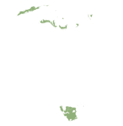
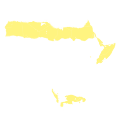
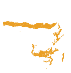
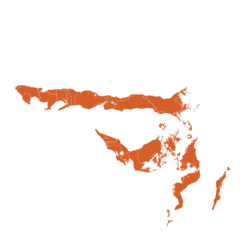
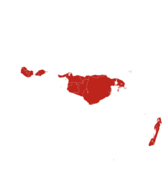
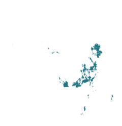
This technology can be used in the colored agro-ecological zones. Any zones shown in white are not suitable for this technology.
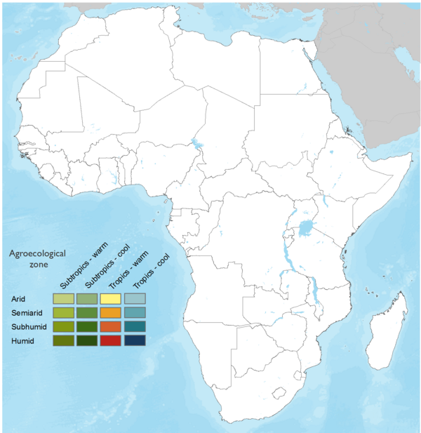
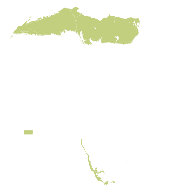




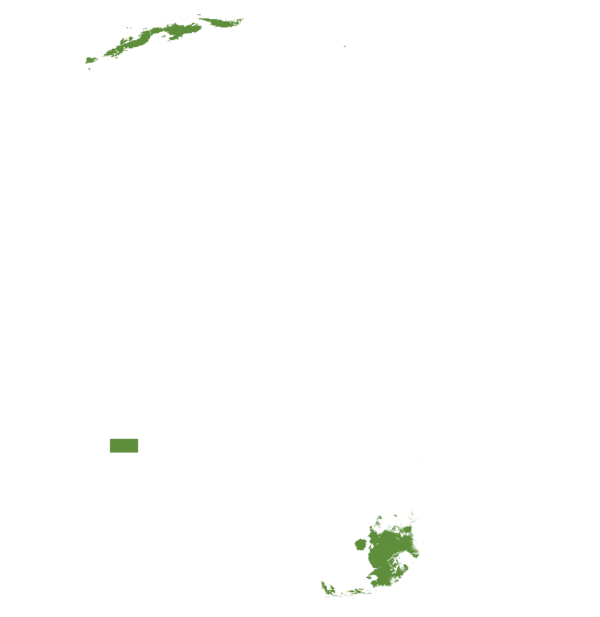


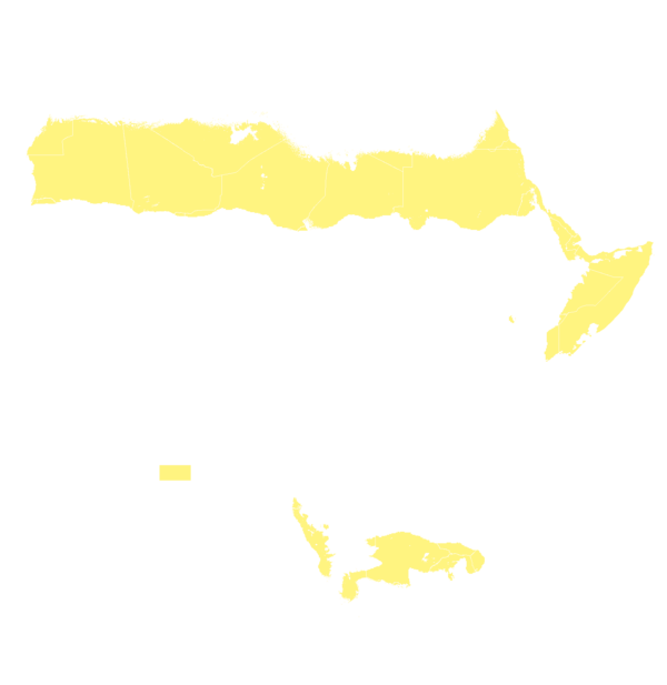
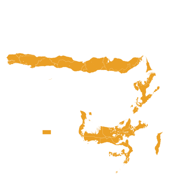
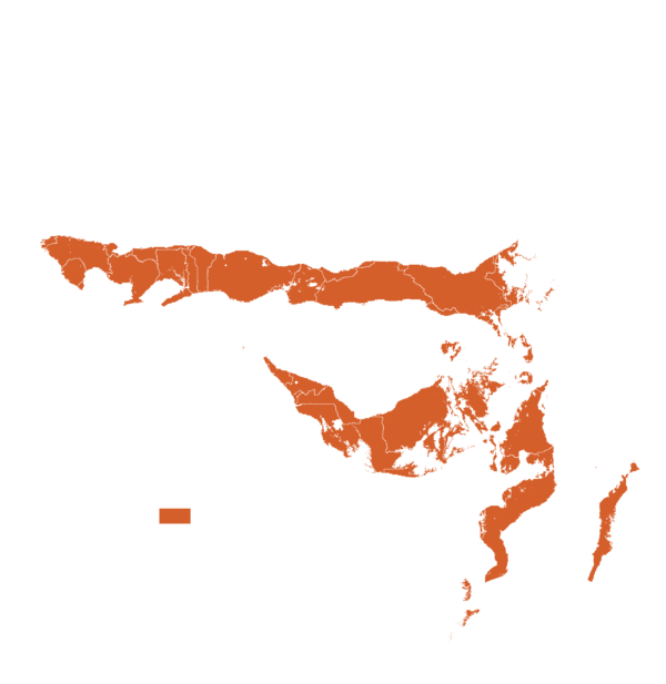



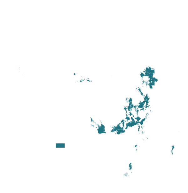

| AEZ | Subtropic - warm | Subtropic - cool | Tropic - warm | Tropic - cool |
|---|---|---|---|---|
| Arid | ||||
| Semiarid | ||||
| Subhumid | ||||
| Humid |
Source: HarvestChoice/IFPRI 2009
The United Nations Sustainable Development Goals that are applicable to this technology.

Helps identify vulnerable farming areas and households so support and investments can be better targeted.
Strengthens food security by improving the targeting of climate-smart agriculture interventions and reducing crop losses from climate shocks.

Supports climate adaptation by tracking farm-level resilience over time and guiding investments toward climate-smart practices.

Promotes collaboration by providing shared, open data that can be used by governments, donors, researchers, and the private sector.

Attuned to mapping accurately the vulnerabilities and resilience scores of marginalized populations that are expected to benefit most from targeted interventions.
Step 1: Inception — Engage with IITA RCA Programme
Contact IITA's Resilience and Climate Adaptation (RCA) Programme to initiate the project. Define the geography (country, region, or project area), identify which climate resilience indicators you need (e.g., land degradation, cropping system stability), and clarify the decision-making questions the resilience evidence must answer. This scoping ensures the platform is tailored to your specific context and objectives.
Step 2: Data and Ground-Truth Collection
Identify available ground-truth datasets that will be used to train and validate the machine learning models. This includes existing household surveys, project monitoring and evaluation (M&E) records, or field data from previous studies. Where calibration is needed, plan a lightweight field-validation campaign in the target landscape to collect ground-truth labels for the supervised machine learning classifiers. The quality of ground-truth data, including any available GPS data points, directly affects model accuracy.
Step 3: Calibration and Validation
ResiliSense models are calibrated for your target agroecological zone using the ground-truth data. Supervised classifiers (Logistic Regression, SVM, Random Forest, Gradient Boosting) are trained with stratified cross-validation, hyperparameter tuning, and 20-seed robustness checks to ensure reliability. The models are validated against ground-truth data before outputs are released, ensuring decision-grade accuracy for your specific context.
Step 4: Baseline Resilience Analysis
Run a baseline resilience analysis over your project area and counterfactual zones (comparison areas without intervention). The platform fuses multi-source Earth observation data— such as Sentinel-1 SAR for cloud-penetrating imagery, Sentinel-2 indices (NDVI, NDMI, NDRE, BSI, SAM) for vegetation and soil condition, CHIRPS for precipitation, ERA5-Land for temperature and wind, and SRTM for slope—through machine learning to produce farm-level predictions with confidence intervals.
Step 5: Embed Resilience Scores in M&E Framework
Build resilience scores directly into your project's results framework so subsequent rounds of analysis directly answer your M&E questions. Define how resilience indicators will be tracked over time, which administrative units or value chains will be monitored, and how confidence intervals and uncertainty estimates will be incorporated into decision-making. Offers guidance on what changes to make to your M&E plan to ensure accurate assessments. This ensures the platform supports ongoing monitoring rather than just one-off assessments.
Step 6: Iteration — Seasonal or Annual Updates
Run seasonal or annual updates to track resilience trends over time. Use confidence intervals and uncertainty estimates when communicating results to stakeholders, acknowledging the limitations of satellite-derived predictions. The platform enables repeatable monitoring, allowing you to see whether resilience is improving or declining across project cycles.
Step 7: Reporting and Decision Support
Use ResiliSense outputs to feed adaptation finance proposals, climate-smart agriculture program baselines and endlines, regenerative agriculture targeting, and CGIAR initiative reporting. Outputs can support NDCs and NAPs reporting, donor board presentations, and internal strategic planning. The platform's open methods (documented algorithms, published validation results, openly released code) supports transparency and reproducibility for all stakeholders.
Last updated on Sep 10, 2026
This technology can be used in the colored agro-ecological zones.












ResiliSense: Satellite-Driven Climate Resilience Measurement Platform
https://e-catalogs.taat-africa.org/gov/technologies/resilisense-satellite-driven-climate-resilience-measurement-platform/embed
Last updated on 10 September 2026, printed on Oct 23, 2026
Enquiries e-catalogs@taat.africa